
Eat, Sleep,
Ride, Repeat
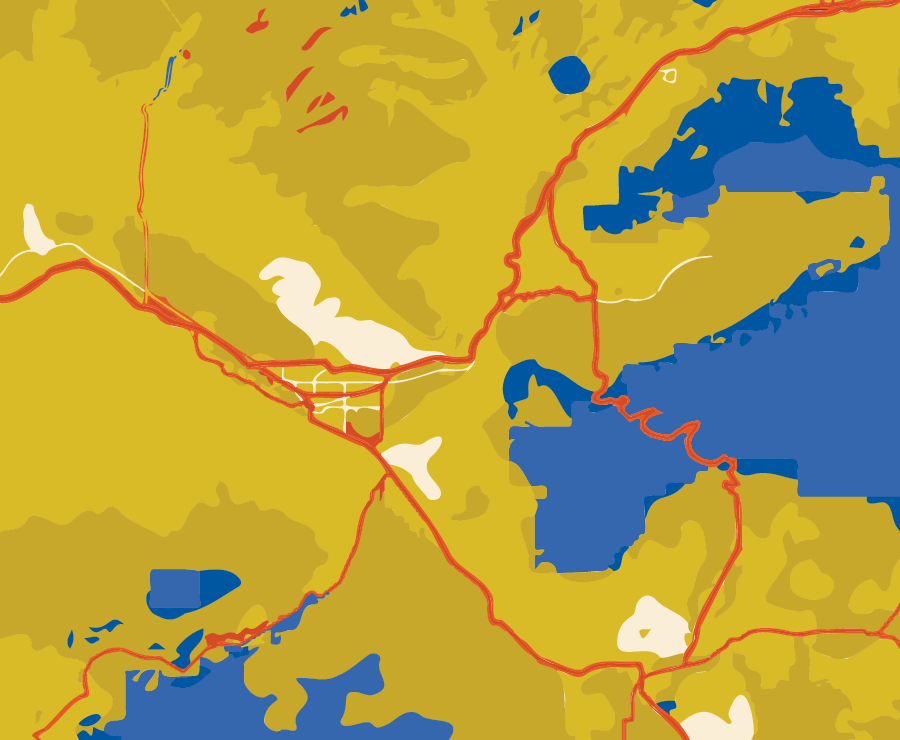
Where to
Ride
Whether you're grinding up a challenging climb on the road or enjoying fast and flowy singletrack, the diversity of cycling experiences in the Grand Valley is second to none. You’ll find excellent riding for most all abilities that extends from the Grand Mesa to McInnis Canyons National Conservation Area.
PALISADE PLUNGE
WEST BENCH TRAIL
COAL CANYON
PALISADE RIM
LUNCH LOOPS
THE RIBBON TRAIL
TURKEY FLATS
GUNNISON RIVER BLUFFS/OLD SPANISH TRAIL
18 ROAD
KOKOPELLI LOOPS
The Grand Mesa - Mountain Biking
Palisade Plunge
The Palisade Plunge begins on top of the Grand Mesa at nearly 11,000’ and traverses 32 miles through diverse terrain, with a 6,000’ descent to the Town of Palisade. It navigates remote, backcountry terrain with some sections of extreme exposure that require high levels of confidence and riding skills. Shorter portions of the ride are available and recommended to get acquainted with the terrain before taking on the entire Plunge. Be sure to bring plenty of food, water, appropriate clothing, and the necessary tools and equipment for bike repairs.
- Trailhead: Mesa Top Trailhead; adjacent to Hwy 65
- Distance: 32 (point to point)
- Elevation Gain / Loss: 1,622’ / -7,624’
- Level of Difficulty: Advanced / Difficult
- Maps:
West Bench Trail #501
The West Bench Trail is located in the Mesa Lakes area on the Grand Mesa and is a favorite destination year round. The trail begins at Jumbo Reservoir and stretches westward under the north rim of the Mesa to the Number 2 lift at Powderhorn Mountain Resort.
- Trailhead: Jumbo Reservoir; adjacent to Hwy 65
- Distance: 11 (out and back)
- Elevation Gain: 425’
- Level of Difficulty: Intermediate
- Maps:
PALISADE - Mountain Biking
Coal Canyon
Located in the Little Book Cliffs Wilderness Area near De Beque, Coal Canyon is where you’ll see herds of wild horses, bighorn sheep and petroglyphs. The wash gully trail that parallels and crosses the access road (multiple times) has varying terrain, to include large exposed rocks that riders may crawl and drop, if so inclined.
- Trailhead: Coal Canyon; Exit 46 off I-70
- Distance: 4.9 miles (out and back) Ride can be extended by way the Hoodoo Trail or following a long wash the runs east-west behind Mount Garfield.
Elevation Gain: 614’
Level of Difficulty: Intermediate
Palisade Rim Trail
Made up of two loops, a lower and upper, the trail offers outstanding views of the valley, Colorado River, Little Book Cliffs, Grand Mesa as well as several petroglyphs. The double lollipop is a narrow singletrack with a number of switchbacks and interesting features. Palisade Rim isn’t for the faint of heart though as the initial climb is rather challenging and you’re often exposed as your ride along the ridge of sheer cliff drops.
- Trailhead: East of Palisade near Jct. of U.S. 6 & I-70; Colorado River Launch Parking
- Distance: 8.7 miles
- Elevation Gain: 1,324’
- Level of Difficulty: Intermediate to Advanced
WHITEWATER - Mountain Biking
Gunnison River Bluffs & Old Spanish Trail
The Gunnison Bluffs Trail is located on the southern side of Grand Junction near the town of Whitewater. The trail travels along the bluffs above the Gunnison River as it winds its way to its confluence with the Colorado River. By combining the Gunnison River Bluffs Trail with the Old Spanish Trail, two loops are formed that provide riders a choice between a 5 or 12 mile excursion. This trail is known for its desert plants and river vistas.
- Trailhead: 1.3 miles west of Whitewater along the Coffman Road
- Distance: 12 miles
- Elevation Gain: 292’
- Level of Difficulty: Intermediate to Advanced
GRAND JUNCTION - Mountain Biking
Lunch Loops
This is a beloved network of singletrack trails, easily accessible by GJ locals for a quick “lunchtime ride”. The trail system consists primarily of difficult to very difficult rides with technical features and tricky lines. Two trails within the system, Free Lunch and Pucker Up, are designated for mountain bikes and downhill travel only. Lunch Loops affords spectacular views as it sits adjacent to the Colorado National Monument and Bangs Canyon and has nice amenities in trailer parking, pit toilets, changing rooms and shaded picnic areas.
- Trailhead: Southwest of Broadway / 340 on Monument Rd.
- Size: 20+ miles
- Elevation Gain/Loss: 2,000+ feet
- Level of Difficulty: Easy to Advanced
- Maps:
The Ribbon
The Ribbon is one of the premier mountain bike rides in the Valley and arguably the most unique slickrock trail east of Moab. From miles away the Ribbon can be seen wrapping its way down a cliff near the Colorado National Monument. Right off the bat, the wide open slickrock affords riders an opportunity to speed downhill at alarming rates, so be sure your brakes are in good working order. The enormous grippy slab is followed by a series of short and somewhat technical transitions and connections; so be sure to follow trail signs carefully. The Ribbon is mostly enjoyed as a shuttle ride and best celebrated with a cold beer at Handlebar!
- Trailhead: North off Little Park Rd. in Bangs Canyon
- Distance: 3.0 miles
- Elevation Gain/Loss: 18’ / -1,414’
- Level of Difficulty: Advanced / Difficult
- Maps:
Turkey Flats
This loop ride is 70% singletrack connected with a short section of USFS road and an ATV trail. There isn’t much for views on the trail itself, but the drive up – to the west – offers panoramic views over the Uncompahgre and into Utah’s canyons. Turkey Flats winds through aspen groves and thick pines and passes a reservoir at the midpoint. For locals it’s a great trail to beat the heat during the dead of summer.
- Trailhead: S 16 ½ Rd.; South of Glade Park in Grand Mesa National Forest
- Distance: 9.5 miles
- Elevation Gain: 1,161’
- Level of Difficulty: Intermediate
- Maps
FRUITA - Mountain Biking
18 Road
Approximately 23 miles from Grand Junction and at the base of the Book Cliffs, is 18 Road – also known as the North Fruita Desert. Created by a group of locals in the mid 90’s, this is singletrack at its best. Elevation varies from 5,300’ to 7,200’, and level of difficulty ranges from easy to advanced. Beginners may want to take a spin on Prime Cut, Kessel Run and PBR, while more technical trails include the “knife edge” of Joe’s Ridge or the even more challenging Zippity Do Da. Come out for a day or stay for several. The trails are all relatively short, which makes it perfect to set up a basecamp and knock out a number of laps.
- Trailhead: On 18 Road; 7 miles north of N 3/10 Road
- Size: 81 miles of trails
- Elevation Gain: Varying
- Level of Difficulty: Easy to Advanced
- Maps:
Kokopelli Loops Area
Just west of Fruita, the many scenic and challenging loops at Kokopelli draw riders from around the state, especially Mack Ridge and Horsethief Bench that sit high along the ridgeline. You will want to dismount a few times and soak up the views overlooking the Colorado River snaking its way through the sheer rock walls of McInnis Canyon. The singletrack trails vary in length (2.3 – 8 miles) and level of difficulty (intermediate to advanced). Steve’s, Lion’s, Troy Built, Rustler’s, Mary’s, Horsethief Bench and Wrangler are all loops, whereas Moore Fun and Mack Ridge are point to point.
- Trailhead: Off I-70 (Exit 15); Gravel frontage road south of interstate
- Size: 52 miles of trail
- Elevation Gain: Varying
- Difficulty: Easy to Advanced
- Maps:
RECOMMENDED ROAD RIDES
Colorado National Monument Loop – Option 1
Start/Finish in Fruita at the Fruita Welcome Center, going counter-clockwise
- Distance: 38 miles / 61 kilometers
- Climbing: 2,350 feet / 715 meters
- Difficulty: Moderate
- Front and rear ‘get you seen’ type lights are required while riding in the tunnels.
- A national parks pass or $15 is required to get into the park.
- Tip: An annual pass costs $45 and admits up to four bicyclists at a time and it’s good for a whole year. So if there’s three or more in your group, this would be the way to go.
Colorado National Monument Loop – Option 2
Start/Finish in Grand Junction at the Lunch Loops Trailhead, going clockwise
- Distance: 35 miles / 56 kilometers
- Climbing: about 2,350 feet / 715 meters
- Difficulty: Moderate. The four mile climb up the east side is fairly steep, though, at 6-8%
- Front and rear ‘get you seen’ type lights are required while riding in the tunnels.
- A national parks pass or $15 is required to get into the park.
Tip: An annual pass costs $45 and admits up to four bicyclists at a time and it’s good for a whole year. So if there’s three or more in your group, this would be the way to go.
Colorado National Monument East Side – Glade Park Loop
- Distance: 34.2 miles / 55.0 kilometers
- Climbing: 3,590 ft / 1,095 meters
- Difficulty: Moderate to Difficult
- Colorado National Monument pass or money required
- Lots of UP. Lots of DOWN too. Not much in between.
Colorado National Monument West Side – Glade Park Loop
- Distance: 42.7 miles / 68.7 kilometers (feels a lot longer)
- Climbing: 3,690 ft / 1,125 meters
- Difficulty: Moderate to Difficult
- Colorado National Monument pass or money required
- Starts out mellow then goes up. And keeps going up. And more up. Then a whole lotta down!
Orchard Mesa – Palisade – East Orchard Mesa Loop
- Distance: 41 miles / 66 kilometers
- Climbing: 731 feet / 223 meters
- Difficulty: Easy for the most part, but one really good hill
Fruita Farms Alphabet Ride
- Distance: 37 miles / 60 kilometers
- Climbing: 742 feet / 226 meters
- Difficulty: Easy….except on a windy day
Rose Hill Rally 100K Ride
- Distance: 64 miles / 103 kilometers
- Climbing: 1,330 feet / 405 meters
- Difficulty: Easy
Fruita Farms Grand Tour
- Distance: 55 miles / 86 kilometers
- Difficulty: Easy, but with a couple hills that’ll get your attention
Reeder Mesa – Purdy Mesa – Kannah Creek Route
- Distance: 33 miles / 53 kilometers
- Climbing: 1,810 feet / 552 meters
- Difficulty: Moderate, but with about half a mile at 9%. Ooof.
- Ride starts in Whitewater. To ride from Grand Junction to the start of this ride, see “Grand Junction to Whitewater” route below.
Little Park Road – Monument Loop
- Distance: 29 miles / 47 kilometers
- Climbing: 2,840 feet / 866 meters
- Difficulty: Moderate to Difficult
- You must have a Colorado National Monument pass, a National Parks Service pass, or be willing to pay the $15 entrance fee in order to complete the loop.
Little Park Road – DS Road
- Distance: 71.0 miles / 114.3 kilometers; Alternate Start/Finish (DS Road only): 40.5 miles / 65.2 kilometers
- Climbing: 4,760 feet / 1,451 meters; Alternate Start/Finish (DS Road only): 1,749 feet / 533 meters
- Difficulty: Moderate to difficult. Difficult climb at the beginning, delightfully mellow after that. With the use of one of those gasoline burning things you can start from the Alternate Start/Finish, skip the difficult climb and just do the delightful part.
- Can be a good winter ride when the valley is socked in with a wretched inversion.
Unaweep Canyon
- Distance: 86 miles / 138 kilometers
- Climbing: 4,900 feet / 1,494 meters
- Difficulty: Moderate to difficult. Route map includes a shorter, easier alternative.
Grand Junction to Whitewater
- This route enables you to ride from Grand Junction to Whitewater to connect to the start of either the Reeder Mesa route or the Unaweep Canyon route.
- Distance: 18 miles / 29 kilometers round trip
- Difficulty: Easy, but tack this onto those other rides and you’ll get a good workout
Douglas Pass
- Distance: 66 miles / 106 kilometers
- Climbing: 4,600 feet / 1,400 meters
- Difficulty: Kicks up at the end, so ‘difficult’ if you head to the top, ‘moderate’ if you turn back at the base. Narrow, busy road, not for the faint of heart.
Grand Mesa Hill Climb
- Distance: 63 miles / 101 kilometers
- Climbing: 6,049 feet / 1,844 meters. All of it in the first half.
- Difficulty: Difficult. “Bright light and dead relatives beckoning” is sort of difficult.
Gravel Riding
COMING SOON
E-BIKES
COMING SOON
Bike Parks
The Grand Valley is fortunate to have five unique Bike Parks to help level up your skills, confidence, and enjoyment on a bike. Not only that but they are an excellent way to get residents, – especially kids – outdoors, attract tourism, improve quality of life, and bring economic growth to the community. Enjoy the features and obstacles at any one of these parks from the Grand Mesa to Fruita.
Fruita Bike Park
From a beginner skills area and pump track, to an intermediate and advanced area full of send- worthy features, Fruita Bike Park is an attraction enjoyed by riders of all skill levels.
Dos Rios Bike Park
Lunch Loops Bike Park
A collection of dirt hills and jumps spread throughout four distinct lines, Lunch Loops Bike Park is a popular destination for the young and young at heart.
CMU Pump Track & Bike Park
A fully functional pump track with rollers and banked turns located on the campus at Colorado Mesa University. This track serves a dual purpose in that its open to the public as well as CMU students but is also home to private training sessions for the CMU cycling team.
Powderhorn Mountain Bike Park
As ski season closes, the spring snowmelt reveals multiple professionally crafted downhill trails that dip, wind and flow with the resort’s natural terrain. Powderhorn’s bike park offers multiple trails that can challenge the most experienced rider and provide easy terrain for those looking to improve their skills. A lift drops you at the top, from there you choose your own adventure as you descend 1,650’.
Palisade Bike Skills Park
Catered to beginners, this skills park is a great place to bring the family, practice your MTB skills and enjoy a day outdoors. Located adjacent to Riverbend Park, it also provides easy access to the local River Trails, allowing biking travel from Palisade to downtown Grand Junction.
Upcoming Events
Community Partners
Bike Shops & Rentals - GJ
Bike Shops & Rentals - Fruita
Bike Shops & Rentals - De Beque
Bike Shops & Rentals - Palisade
Advocacy & Stewardship
Manufacturers
Bike Shuttle Services
Teams, Clubs & Social Groups
Youth Clinics & Programs
Etiquette on the Trails
Riding your local mountain bike trails comes with responsibility – respect the soil, the trail system, and your fellow trail users.